One thing you quickly realize about Cambodia, is that addresses mean very little here. Yes, streets have names, unfortunately normally two, english and Khmer. Building numbers are basically non existent, and when you ask for your house address, you get a blank stare.
So how then do you find things around Cambodia?
Well, you can like others that i see, pay a local tuck tuck driver to hopefully take you to the right place, walk up and down town in search of what you want, post on Facebook for locals to help (which normally goes like, yes, the small store 5 min from the old market), or you can like me, tech up.
I love gadgets, and used with normal maps and observation, can go a long way. I have 5 different apps for my iPhone and iPad, that lists a host of places that i can search for by name. These applications pull in data from a number of different sources, such as wikipedia, google maps, user uploads, and a number of other sources. This allows one to get exact GPS coordinates on places, and navigate to these places, with the use of the internet GPS in the iPhone and iPad (needs a cell card one).
However, good as the Apple GPS is in these devices, they are not always good enough when moving between buildings, inside market places, and narrow streets with trees or so. This is where i use a little bit of extra help.
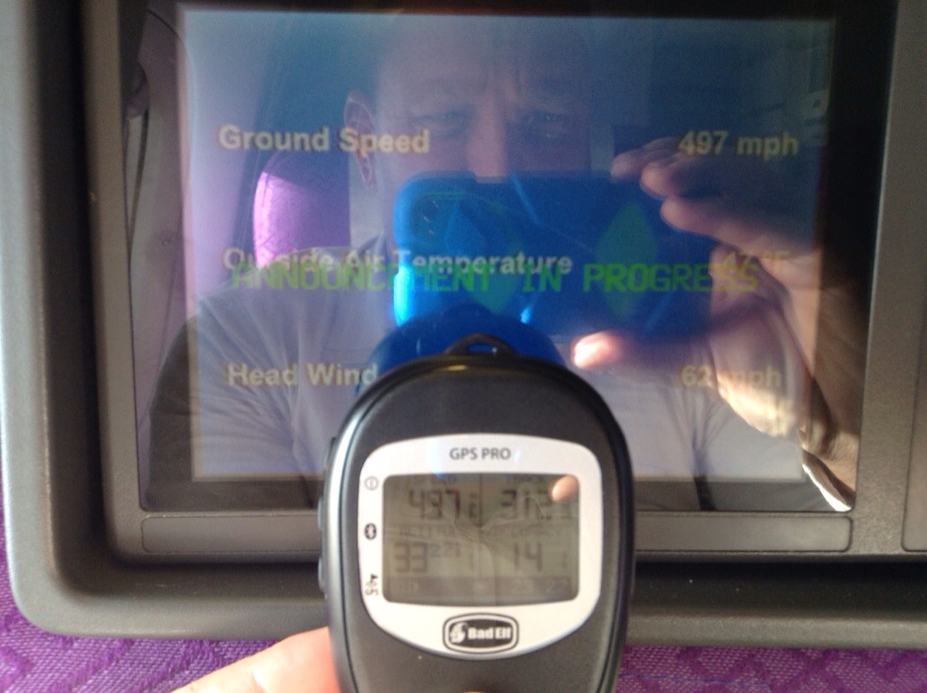
Meet Bad Elf, a GPS receiver, that connects to your Apple product via bluetooth, and gives exceptional accuracy. The device is actually intended for pilots, and is rated for up to 60 000ft, and 1000 miles/h. I tested it on the flights, and it compared not to bad with the onboard flight information.
Your Apple product uses the information from the device, and improves your location accuracy considerably. It also allows you to tract back using photos. If I pass a stall or shop on my way to another shop, that has something that interests me, I just take a picture of the item in the stall or a picture of the shop. Later, I use a different application that shows me exactly on a map where each picture was takes, using the GPS coordinates of the picture. This allows me to let the application plan a route to any spot I have been if I later want to go back to it.
So if you want to improve your GPS accuracy on your apple product, (works even with an iPod touch) and turn your apple product into and extreme GPS device, get yourself one of these bad boys. Got mine on Amazon. Note, as far as I know they only work with apple products.

Why not just buy a proper GPS?
A proper GPS is reliant on the maps that the manufacturer gives. There are not many maps for Asia, especially in rural villages. The maps are also not updated often. With a smartphone, you get many free map application as well as Google Maps that are very accurate. Google Maps are currently making a big effort into mapping south east Asia.
In addition, having a dedicated GPS device is another de ide that needs charging and can get stolen, and taking pictures with a GPS enabled phone allows you to tag the pictures with the coordinates to allow you to map your own map with pictures (needs an app)